
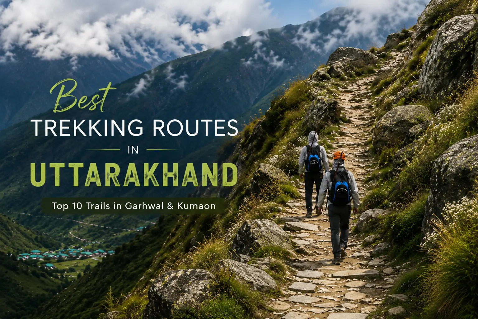
Uttarakhand welcomes you, whether you want a short Himalayan hike, a winter snow trek, an alpine flower experience or a long glacier journey, Uttarakhand has trekking routes for different fitness levels, interests and travel styles.
The state has a lot of trekking trails across Garhwal and Kumaon. In Garhwal, trekkers can explore the Valley of Flowers, snowy forests of Kedarkantha, the mountain views around Kuari Pass and the traditional villages of Har Ki Dun. In Kumaon, the experience changes towards quieter trails, glacier routes and remote mountain valleys around Munsiyari, Pindari and Panchachuli.
Along the way, trekkers can experience oak and rhododendron forests, alpine meadows, mountain streams, vallies snow-covered ridges, temples and Himalayan villages.
This guide article Uttarakhand Taxi Service covers 10 of the best trekking routes in Uttarakhand, along with their starting points, difficulty, duration, best season and what each trek is best suited for.
| Trek | Region | Starting Point | Difficulty | Approx. Duration | Best Season | Ideal For |
|---|---|---|---|---|---|---|
| Valley of Flowers | Garhwal | Govindghat | Moderate | 4–6 days | July–September for flowering season | Flowers and nature |
| Kedarkantha | Garhwal | Sankri | Easy–Moderate | 4–6 days | Winter for snow | Beginners and snow |
| Nag Tibba | Garhwal | Pantwari | Easy | 1–2 days | Winter, spring and autumn | Weekend trekking |
| Kuari Pass | Garhwal | Auli/Joshimath region | Moderate | 5–6 days | Spring and autumn | Himalayan views |
| Har Ki Dun | Garhwal | Sankri | Moderate | 6–7 days | Spring and autumn | Villages and valleys |
| Roopkund | Garhwal | Lohajung | Difficult | 7–9 days* | Check current access | Experienced trekkers |
| Pindari Glacier | Kumaon | Loharkhet | Moderate | 6–8 days | Depends on conditions | Glacier trekking |
| Milam Glacier | Kumaon | Munsiyari | Difficult | 10–12+ days | Check current access | Experienced trekkers |
| Munsiyari–Khaliya Top | Kumaon | Munsiyari/Balati Bend | Easy–Moderate | 2–3 days | Winter, spring and clear-weather periods | Short Himalayan adventure |
| Panchachuli Base Camp | Kumaon | Dugtu, Darma Valley | Moderate | 5–7 days | Depends on weather and access | Remote Himalayan landscapes |
Trek difficulty is not decided by distance alone. Altitude, elevation gain, weather, trail conditions, duration and remoteness can all affect how difficult a trek feels and the level of difficulty will be different for all.
The difficulty levels used in this guide are broad indicators. Actual conditions depend on.
Easy treks generally involve shorter walking days, lower altitude and relatively manageable terrain. They can be suitable for fit beginners.
Example: Nag Tibba
These treks require basic trekking fitness and preparation for longer climbs, uneven trails or changing weather.
Example: Kedarkantha and Khaliya Top
Moderate treks usually involve several days of walking, elevation gain and longer trekking days. Some previous hiking experience can be useful.
Examples: Kuari Pass, Har Ki Dun and Pindari Glacier
Difficult treks generally involve higher altitude, longer duration, remote terrain or more demanding trail conditions. They require better preparation and experience.
Examples: Milam Glacier and traditional Roopkund routes, subject to current access.
Important: Difficulty ratings are approximate and can change depending on weather, route conditions, itinerary, altitude and individual fitness.
Region: Garhwal
Starting Point: Govindghat
Difficulty: Moderate
Typical Duration: Around 4–6 days, depending on the itinerary
Best Season: July to September for the main flowering period
The Valley of Flowers is one of Uttarakhand’s well known trekking trails and destinations. Located in Chamoli district, the valley is part of the Nanda Devi and Valley of Flowers National Parks and is known for its Himalayan landscape and alpine biodiversity.
The main attraction is the seasonal transformation of the valley. During the flowering period, alpine plants cover the meadows with different colours.
The trek combines forests, waterfalls, streams, open meadows and high Himalayan scenery. The Pushpawati Valley forms the heart of the experience, making this a trek where the landscape itself is the main attraction rather than a summit.
The route also connects with Hemkund Sahib, allowing travellers with suitable time and conditions to combine both experiences.
The gateway is Govindghat and continues towards Ghangaria, which is an important base for visiting the Valley of Flowers and Hemkund Sahib.
The exact number of trekking days depends on the itinerary.
The main flowering period is generally July to September, although conditions can vary from year to year.
Mountain weather can change quickly, especially during the monsoon, so check the latest trail and weather conditions before travelling.
Camping inside the Valley of Flowers is not permitted. Visitors return to Ghangaria after exploring the valley and should follow the prescribed timings.
Best for: Alpine flowers, nature photography, scenic landscapes and travellers looking for a high-altitude valley experience.
Region: Garhwal
Starting Point: Sankri
Difficulty: Easy to Moderate
Typical Duration: 4–6 days
Best Season: Winter for snow
Kedarkantha is one of Uttarakhand’s well-known winter trekking routes. It is popular for beginners and first time trekkers who want to experience snow and a Himalayan summit without choosing a highly technical expedition.
The trek begins around Sankri, which is also a gateway to several trekking routes in the region.
The route passes through forests, open meadows and, during winter, snow-covered areas before the final climb towards the summit.
The route passes through Govind Pashu Vihar National Park, and the summit is around 3,800 metres.
The summit day is generally the most celebrated part of the trek. An early start and steady walking are important, especially during cold or snowy conditions.
From the summit area, trekkers can get views towards surrounding Himalayan peaks such as Swargarohini, Bandarpoonch and Kala Nag, depending on weather and visibility.
Kedarkantha is suitable for physically active beginners, but beginner-friendly does not mean effortless. Altitude, cold weather and the summit climb still require preparation.
Best for: First-time trekkers, snow lovers, groups and travellers looking for a classic winter Himalayan trek.
Region: Garhwal
Starting Point: Pantwari
Difficulty: Easy
Typical Duration: 1–2 days
Best Season: Winter, spring and autumn, depending on conditions
If you have limited time but still want a Himalayan trekking experience, Nag Tibba is the best practical option.
The trek is commonly approached from Pantwari village and is popular for short trips from the Dehradun and Mussoorie side.
Nag Tibba offers a compact mountain experience of trekking.
The trail passes through village surroundings and forests before reaching higher open areas. During suitable winter conditions, snow adds another attraction to the route.
The trail includes forest sections, rocky stretches and gradual climbs. The Nag Devta temple is one of the features encountered on the route from Pantwari.
As the trail gains height, the landscape opens up and mountain views become more prominent.
A short itinerary can involve travelling to Pantwari on the first day, trekking to the overnight point and completing the summit and descent the next day.
Allow enough time for the road journey because mountain travel times can change with road and weather conditions.
Best for: Beginners, weekend travellers, short trips from Dehradun and first-time trekkers.
Region: Garhwal
Starting Point: Auli/Joshimath region
Difficulty: Moderate
Typical Duration: 5–6 days
Best Season: Spring and autumn
If mountain views are your aim for trekking, Kuari Pass is one of the classic Garhwal routes to consider.
The trek is also associated with Lord Curzon’s Trail.
The main attraction of Kuari Pass is its mountain panorama.
The trail passes through forests and alpine meadows before opening towards wider views of the surrounding Himalayan peaks.
Depending on the route and itinerary, trekkers may experience:
Spring and autumn are attractive periods for trekking and mountain views. Winter and early spring can bring snow to higher sections, but actual conditions vary each year.
Trekkers should be prepared for changing temperatures, steep sections and long walking days.
Kuari Pass is better suited to people who are comfortable with sustained uphill walking. It may not be the best first trek for someone without regular walking or hiking experience.
Best for: Himalayan views, photographers, experienced beginners and trekkers looking for a classic Garhwal route.
Region: Garhwal
Starting Point: Sankri
Difficulty: Moderate
Typical Duration: 6–7 days
Best Season: Spring and autumn
For travellers who want to experience villages, valleys and mountain life, Har Ki Dun offers a different kind of Himalayan trek.
Instead of focusing mainly on reaching a summit, the route leads deeper into a Himalayan valley surrounded by forests, rivers, meadows and traditional settlements.
The journey is as important as the destination.
Over several days, trekkers move through forests, open meadows and valley landscapes. The route also offers views towards the Swargarohini mountain group.
One of the important features of Har Ki Dun is its connection with Himalayan villages. Traditional architecture, farming and local lifestyles become part of the trekking experience.
Har Ki Dun shows that trekking does not always have to be about climbing to the highest possible point.
The route allows travellers to spend more time within the landscape, with forests, villages and valleys forming a major part of the experience.
Sankri is the main gateway, after which the trail continues through villages and camping locations depending on the itinerary.
Spring and autumn are popular periods for comfortable trekking and clearer mountain views.
Best for: Nature lovers, photographers, village experiences and travellers looking for a slower Himalayan journey.
Region: Garhwal
Traditional Starting Point: Lohajung
Difficulty: Difficult
Typical Duration: Around 7–9 days for itineraries that are permitted and operational
Roopkund has long been one of the most discussed trekking trails in Uttarakhand. The route is associated with the high-altitude Roopkund Lake and the alpine landscapes around Bedni Bugyal.
The area also became widely known because of human skeletal remains found around the lake, which have attracted historical and scientific interest.
Bedni Bugyal is one of the major landscape highlights, with broad mountain views including peaks such as Trishul and Nanda Ghunti.
The route is challenging because of high altitude, steep climbs, long walking days, cold conditions and changing mountain weather.
Roopkund requires special attention to current access conditions.
Its operational status, route access, permits and restrictions should be confirmed with the relevant local authorities before making a trekking plan.
Best for: Experienced trekkers who have confirmed that the intended route and season are currently permitted.
Region: Kumaon
Common Approach: Loharkhet towards Khati and the Pindari Valley
Difficulty: Moderate
Typical Duration: Around 6–8 days
Best Season: Depends on snow, rainfall and trail conditions
The Pindari Glacier Trek is one of the established trekking experiences of Kumaon.
It takes travellers through forests, villages and river valleys before reaching the glacier landscape.
A commonly used approach begins at Loharkhet and continues towards Khati before moving deeper into the Pindari Valley.
The landscape gradually changes from village and forest sections to more open mountain terrain.
The Pindari River and surrounding peaks are important features of the route.
Pindari is not only about reaching the glacier.
The journey through villages, forests and river valleys is an important part of the experience. Loharkhet is an important base for trekking in this part of Kumaon.
The best trekking period depends on snow, rainfall and trail conditions. During the monsoon, heavy rain can affect mountain roads and trails.
Best for: Travellers looking for a Kumaon trekking experience, glacier landscapes and multi-day mountain walking.
Region: Kumaon
Starting Point: Munsiyari
Difficulty: Difficult
Typical Duration: 10–12+ days
For experienced trekkers looking to explore deeper into the Kumaon Himalayas, the Milam Glacier route offers a long journey through a remote mountain valley.
The trek begins around Munsiyari and follows the Goriganga Valley towards the high Himalayan landscape of Milam.
The route passes through the traditional mountain environment of the Johar region, including the route towards Milam village.
As the trek continues, the landscape gradually changes from inhabited mountain valleys to more remote and higher-altitude terrain.
The challenge comes from:
Because of these conditions, Milam is more suitable for experienced trekkers.
Munsiyari is an important base for high-altitude trekking in Kumaon.
Because Milam lies in a sensitive high-altitude and border-region landscape, travellers should check current permissions, identification requirements, route access and local regulations before departure.
Best for: Experienced trekkers looking for remote Himalayan landscapes, long-distance trekking and the traditional mountain environment of Kumaon.
Region: Kumaon
Starting Point: Munsiyari/Balati Bend approach
Difficulty: Easy to Moderate
Typical Duration: 2–3 days
Best Season: Winter, spring and suitable clear-weather periods
If you want a shorter trek in Kumaon without committing to a long glacier expedition, Khaliya Top is the best option around Munsiyari.
The route leads towards an alpine meadow and offers wide views of the Himalayan peaks around Munsiyari.
The trail passes through forests before opening into a higher meadow landscape.
Best Views of Panchachuli, Nanda Devi, Hardeol, Nandakot and Rajrambha are among the main attractions.
Kaliya Top as a snow-covered alpine meadow and classifies the route as easy to moderate, while noting that some sections are steep.
Khaliya Top changes with the seasons.
Snow makes the landscape particularly attractive during winter and early spring, while warmer months reveal the green meadow with the environment.
While the route is accessible to beginners possessing a moderate level of physical fitness, the steep gradients and high altitude require careful preparation and respect.
Travellers can also spend time around Munsiyari and explore its local surroundings.
Best for: Beginners, short Himalayan trips, photographers and travellers looking for panoramic Kumaon views.
Region: Kumaon
Starting Point: Dugtu, Darma Valley
Difficulty: Moderate
Typical Duration: Around 5–7 days
Best Season: Depends on weather and local access
The Panchachuli Base Camp Trek is one of the more remote Himalayan journeys in Kumaon.
The Panchachuli peaks dominate the landscape of the Darma Valley and provide the main visual attraction of the trek.
The journey combines mountain scenery with the culture and landscape of the Darma Valley.
Travellers pass through remote villages, river valleys and traditional settlements before reaching the base-camp area.
Uttarakhand Tourism Promotes the traditional villages, local homestay experience and views of Panchachuli in the Darma Valley. Dugtu is identified as the starting point for the Panchachuli Base Camp Trek.
The village experience is an important part of this route.
The Darma Valley has its own traditional houses and mountain lifestyle. Where local accommodation is available, staying in a homestay can help travellers experience the region beyond its scenery.
The best trekking period depends on weather and local access. Road conditions, permissions and the current status of the route should be checked before travelling.
Best for: Remote Himalayan landscapes, Panchachuli views, village experiences and travellers looking for a quieter Kumaon adventure.
The right trek depends on your available time, fitness level, experience and the kind of Himalayan experience you want.
| Your Priority | Recommended Trek |
|---|---|
| First Himalayan trek | Nag Tibba |
| Winter snow | Kedarkantha |
| Alpine flowers | Valley of Flowers |
| Himalayan mountain views | Kuari Pass |
| Villages and valley walking | Har Ki Dun |
| Glacier trekking | Pindari Glacier |
| Long and remote trekking | Milam Glacier |
| Short Kumaon adventure | Munsiyari–Khaliya Top |
| Panchachuli views and local culture | Panchachuli Base Camp |
| High-altitude adventure | Roopkund, subject to current access |
There is no single answer to whether Garhwal or Kumaon is better for trekking. Both regions offer different experiences.
Garhwal has some of the most recognised trekking destinations in Uttarakhand, including:
Many Garhwal trails have established approaches through places such as Sankri, Govindghat and Joshimath.
The region is a good choice if you want famous Himalayan landscapes, alpine meadows, snow trekking and established trekking routes.
Kumaon is a good choice if you want a quieter and more remote Himalayan experience.
Important trekking areas include:
The trekking landscape can feel more remote as you move deeper into the valleys around Munsiyari and Pithoragarh.
Choose Garhwal if you want famous trekking routes, snow trails, alpine meadows and established trekking destinations.
Choose Kumaon if you prefer remote landscapes, glacier routes, traditional villages and quieter mountain experiences.
The right choice depends on your time, fitness, experience and interests.
There is no single best month for every trek in Uttarakhand.
The ideal season depends on altitude, location, snowfall, rainfall and the type of landscape you want to see.
Spring is a good time for lower and mid-altitude trekking.
Forests become greener, daytime temperatures are generally comfortable and rhododendrons add colour to many mountain landscapes.
Higher trails may still have snow, so check conditions for your particular trek.
Summer is a popular trekking period before the main monsoon.
As snow reduces, several higher routes become more accessible. Popular trails can also be busier during holiday periods.
Monsoon is particularly important for the Valley of Flowers, as the flowering landscape develops during this period.
However, rain can also bring:
Always check actual weather and local trail conditions before travelling.
Autumn is a good period for trekkers who want clear Himalayan views.
After the monsoon, visibility can improve, making this season attractive for mountain photography and panoramic views.
Winter changes the landscape of many trekking routes.
Snow becomes the main attraction on suitable routes, particularly around destinations such as Kedarkantha and, when conditions permit, Nag Tibba.
Winter trekking requires proper clothing, footwear and cold-weather preparation.
A trekking journey starts before you reach the trail.
Many trekking gateways require several hours of road travel from major cities and transport hubs. Depending on the route, travellers may need transportation to:
Travellers may plan their road journey from major arrival points such as Dehradun, Haridwar, Rishikesh, Haldwani and Kathgodam, depending on the trek.
For groups, families and travellers carrying trekking equipment, a pre-booked taxi can make the journey to remote trekking gateways more convenient. Choose the vehicle according to your group size, luggage and route.
Travellers can pre-book a local taxi from Dehradun, Haridwar, Rishikesh, Haldwani or Kathgodam to trekking gateways across Garhwal and Kumaon.
Choose the vehicle according to your group size, luggage and route.
Explore Uttarakhand Taxi Service for transportation options to trekking destinations across Uttarakhand.
Before booking your transportation, confirm:
For remote destinations, keep some flexibility in your schedule because mountain travel times can change due to weather and road conditions.
Your packing list should change according to altitude, season and trek duration.
For most multi-day Himalayan treks, useful items include:
For winter treks, add thermal layers, gloves, woollen socks and other suitable cold-weather equipment.
For high-altitude routes, packing should be planned more carefully than for a short forest trek.
The Himalayas are beautiful, but mountain conditions should never be taken lightly.
Mountain weather can change quickly. Check the forecast before leaving and ask local authorities, guides or experienced local operators about actual trail conditions.
Some trekking areas are protected landscapes or sensitive border regions. Entry rules, permits and route restrictions can apply.
Some trekking areas are protected landscapes or sensitive border regions. Entry rules, permits and route restrictions can apply.
Do not depend only on an old blog or social media post for current access information.
For remote or regulated routes, follow the local system for guides, permits and operators.
Local guides can also provide useful information about weather, route changes and mountain conditions.
Some established routes may be suitable for independent trekking, but remote and high-altitude routes should not be treated like ordinary hiking trails.
For difficult or unfamiliar routes, travel with a suitable group and experienced guide.
Altitude affects people differently.
Do not rush your ascent simply because you have a fixed itinerary. Give your body enough time to adjust, especially on high-altitude routes.
Symptoms such as unusual headache, dizziness, nausea, severe tiredness or breathing difficulty should not be ignored at altitude.
If symptoms become serious or worsen, follow appropriate medical and descent advice instead of continuing just to complete the trek.
Carry your identification, important contact numbers and required documents in a safe and accessible place.
Mobile connectivity may be unreliable in remote Himalayan areas, so do not depend entirely on your phone.
If the weather becomes dangerous, turning back can be the right decision.
A mountain trek is not a competition. Reaching safely is more important than completing an itinerary.
Many trekking routes pass through villages where tourism supports local livelihoods.
Respect local customs, private property, religious places and village life.
If there is no suitable waste collection facility on the trail, take your non-biodegradable waste back with you.
The Himalayan environment is fragile. Responsible travel should therefore be an important part of every trekking plan.
Try to leave trails and camping areas as you find them.
Do not leave wrappers, bottles, tissues or other waste behind.
Carry reusable bottles and bags wherever possible.
Reducing plastic waste is especially important in remote mountain areas where waste collection can be difficult.
Do not feed wild animals, chase them for photographs or disturb their natural behaviour.
Avoid creating shortcuts.
Walking off established trails can damage vegetation and increase soil erosion.
Alpine meadows are delicate ecosystems. Avoid unnecessary walking through vegetation and do not pick flowers.
This is especially important in protected landscapes such as the Valley of Flowers.
Where available, use local guides, homestays and other legitimate local services.
This helps more tourism income remain within mountain communities.
Ask before photographing people or entering private spaces.
Treat religious places and local traditions with respect.
There is no single best trek for everyone. Valley of Flowers is a strong choice for alpine flowers, Kedarkantha for winter trekking, Kuari Pass for Himalayan views and Har Ki Dun for valleys and village experiences.
2. Which trek in Uttarakhand is best for beginners?
For a short first trek, Nag Tibba is one of the more accessible options. Khaliya Top is another option for reasonably fit beginners. Kedarkantha can also be considered by beginners with proper preparation, especially those interested in snow trekking.
3. What is the best time for trekking in Uttarakhand?
The best time depends on the trek. Spring and autumn are suitable for many routes, summer works for several higher trails before the monsoon, July to September is important for Valley of Flowers, and winter is preferred for snow trekking.
4. Which are the best treks in Garhwal?
Some of the best-known Garhwal trekking routes include Valley of Flowers, Kedarkantha, Nag Tibba, Kuari Pass, Har Ki Dun and Roopkund. Always check current route access before travelling.
5. Which are the best treks in Kumaon?
Popular Kumaon options include Pindari Glacier, Milam Glacier, Khaliya Top and Panchachuli/Darma Valley routes.
6. Is trekking in Uttarakhand safe for beginners?
Many established treks can be suitable for beginners, but safety depends on the route, season, weather, fitness and preparation.
A short trek such as Nag Tibba is very different from a high-altitude route such as Milam.
Beginners should choose an appropriate route, avoid rushing, follow local instructions and use experienced guides where required.
7. Do I need a permit for trekking in Uttarakhand?
Permit requirements depend on the trek and the area. Protected areas, national parks and sensitive border-region routes may have specific entry requirements.
Always confirm the current requirements with the relevant authority or authorised local trekking operator before departure.
8. Which Uttarakhand trek is best for families?
For families with older children and reasonable fitness, a shorter route such as Nag Tibba may be more practical than a long high-altitude trek.
Valley of Flowers can also be considered by families who are comfortable with sustained walking and altitude, but it should not be treated as an easy sightseeing excursion.
9. Which trek offers the best Himalayan views?
Kuari Pass is a strong choice for panoramic Himalayan views. Khaliya Top in Kumaon also offers views of major Himalayan peaks, including Panchachuli and Nanda Devi.
10. Which is the best winter trek in Uttarakhand?
Kedarkantha is one of Uttarakhand’s best-known winter trekking routes because of its snow-covered forests, meadows and summit experience. Actual snow conditions can change each year, so check the latest conditions before travelling.
Uttarakhand offers trekking experiences for different interests, fitness levels and travel plans.
The right trek depends on your experience, available time, fitness and the kind of Himalayan landscape you want to explore.
Garhwal offers several well-known trekking routes, while Kumaon provides glacier routes, remote valleys, traditional villages and quieter mountain experiences.
Before starting your trek, check the latest weather conditions, road access, trail status, permits and local regulations. Conditions in the Himalayas can change quickly, and access can vary from one season to another.
Choose a route that matches your ability, travel responsibly, respect local communities and help protect Uttarakhand’s fragile mountain environment.
The mountains are not just a destination to reach. They are a landscape to experience, understand and leave behind with care.
A local taxi service operator in Uttarakhand Haldwani with local and expert drivers.
© 2026 all rights Reserve @Uttarakhandtaxiservice

